

Features.
OnStation was built with contractors in mind. Check out some of the critical features that set us apart from the competition.
LOCATION
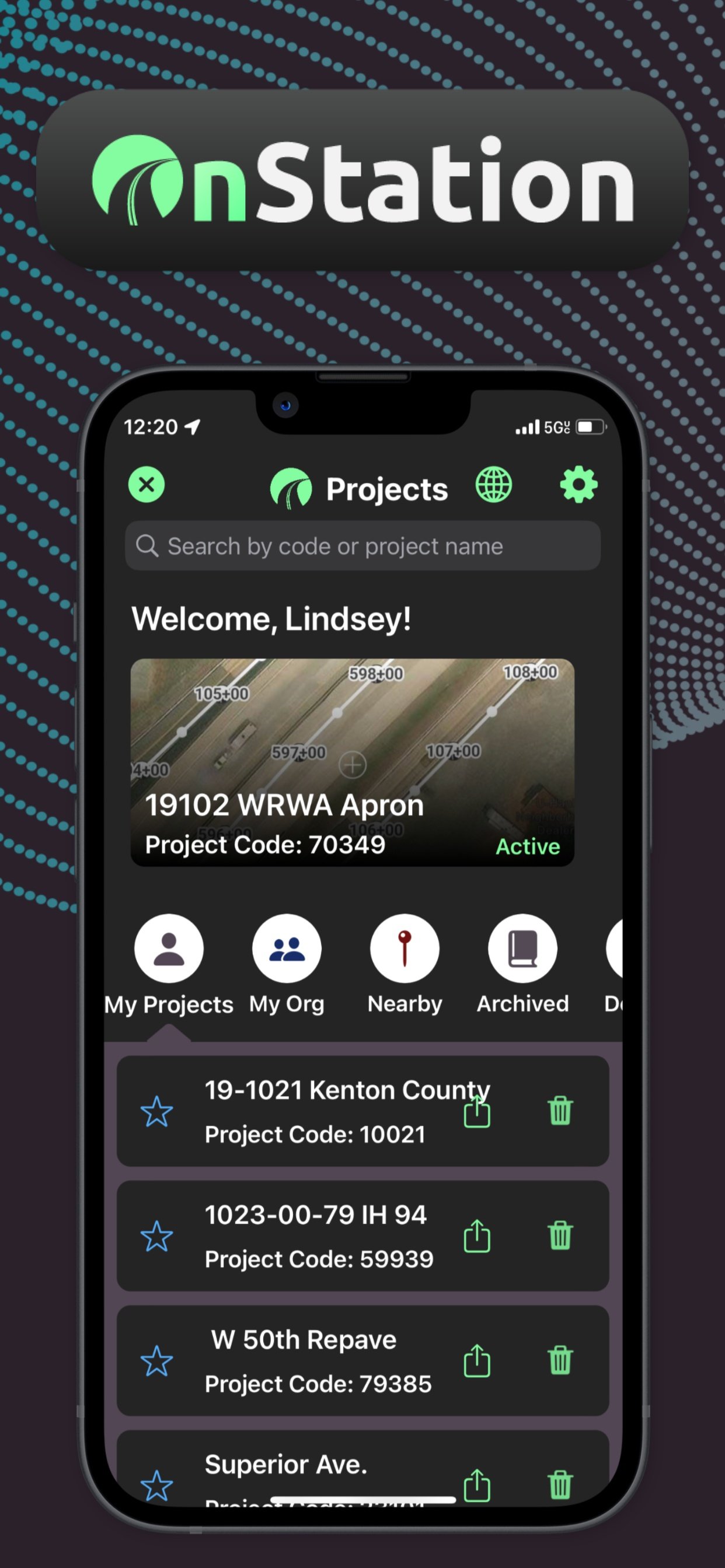
Station Finder
Easily find yourself on a jobsite or a referenced location right within the OnStation app. Location measurement include stationing, mile marker, lat/long, and LRS.
Offline mode is available to all users so you’ll always have reliable stationing at your fingertips.
“It’s the most reliable and accurate tool I use on a daily basis.”

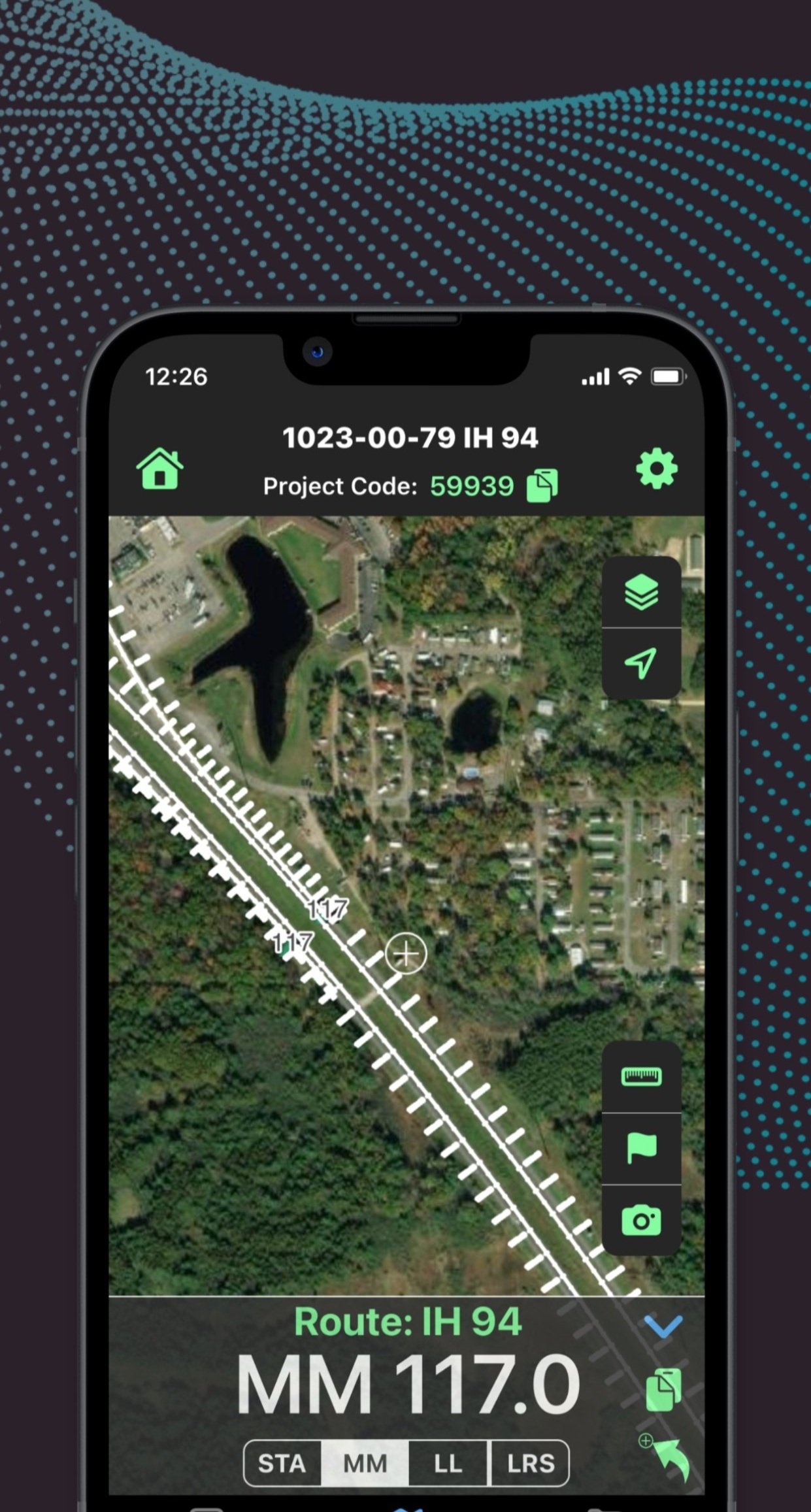
LOCATION
Mile Marker
Available upon request, our Station Finder feature can be converted to operate from your statewide milepost network. This allows OnStation to provide value on the numerous smaller jobs where survey data and project documents might be limited.
“I’m lost without OnStation.”
DOCUMENTATION
Flag & Chat
A communication tool that records and organizes the 100s of project-related conversations that occur on the job every week. Drop a flag on any point of interest. Start a chat to record your notes with text, pictures, and video. Add project contacts to collaborate and solve issues faster!
“It is really good for sharing information and retaining information. Unlike text messages which can’t become part of the files.”

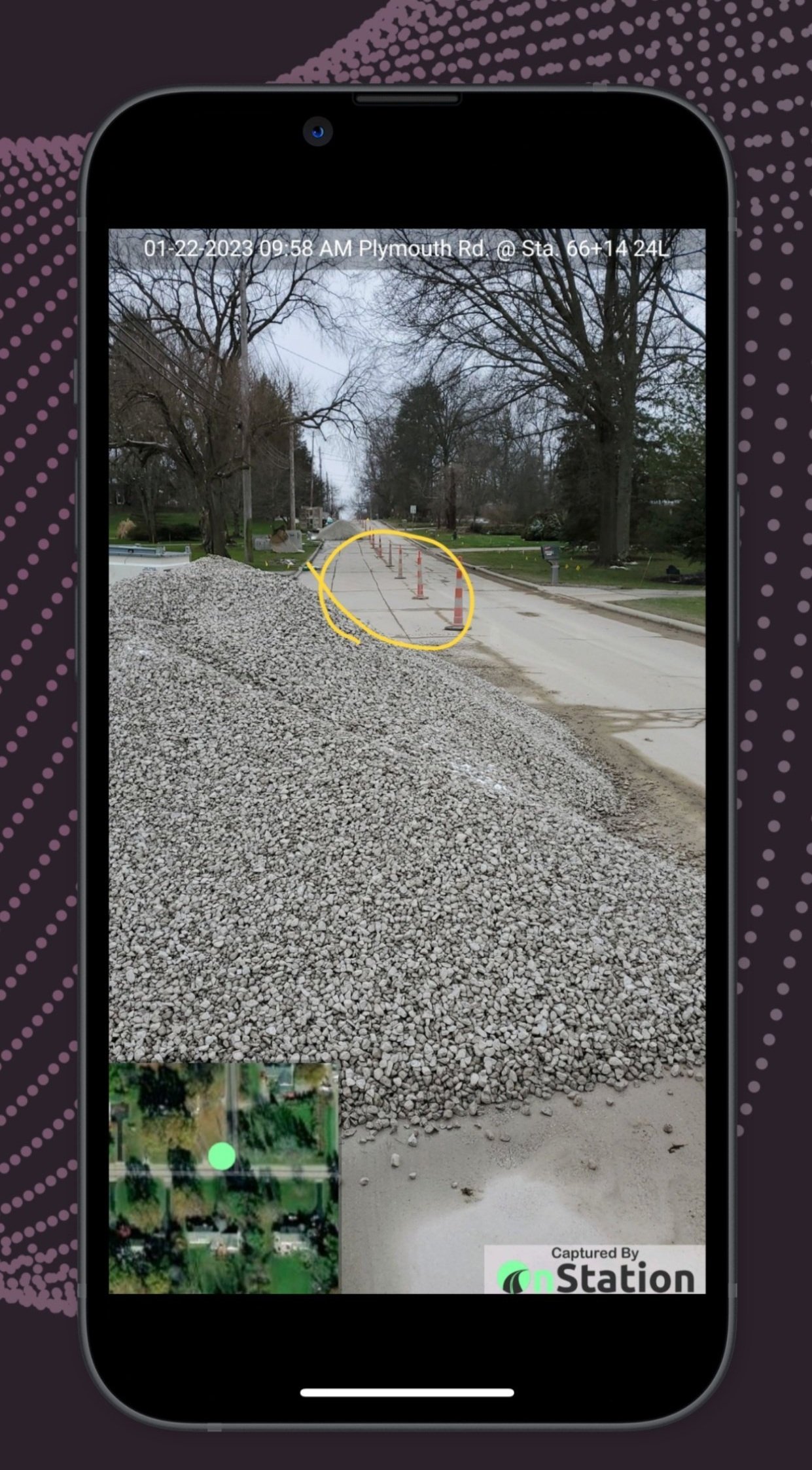
DOCUMENTATION
Camera Notes
The OnStation Camera Note feature delivers location-stamped photos in a snap. Stop texting pictures with no data on them to your co-workers. Stop emailing photos to yourself so you can open a Word document, add the photo, add some text, then save as a PDF. OnStation does it better.
“Site documentation became easy and fast having a tool that allows me to take photos with location, date/time and notes.”
VISUALIZE
Design Layers
Access and view your project design drawings and GIS maps right on the map instantly. Plans, specs, and standards go in the Project Plans section. An additional option to include a direct integration to your cloud based storage account makes staying current even easier.
“The design layers are pretty cool. I had an area where I was laying stone shoulder and I used this feature.”
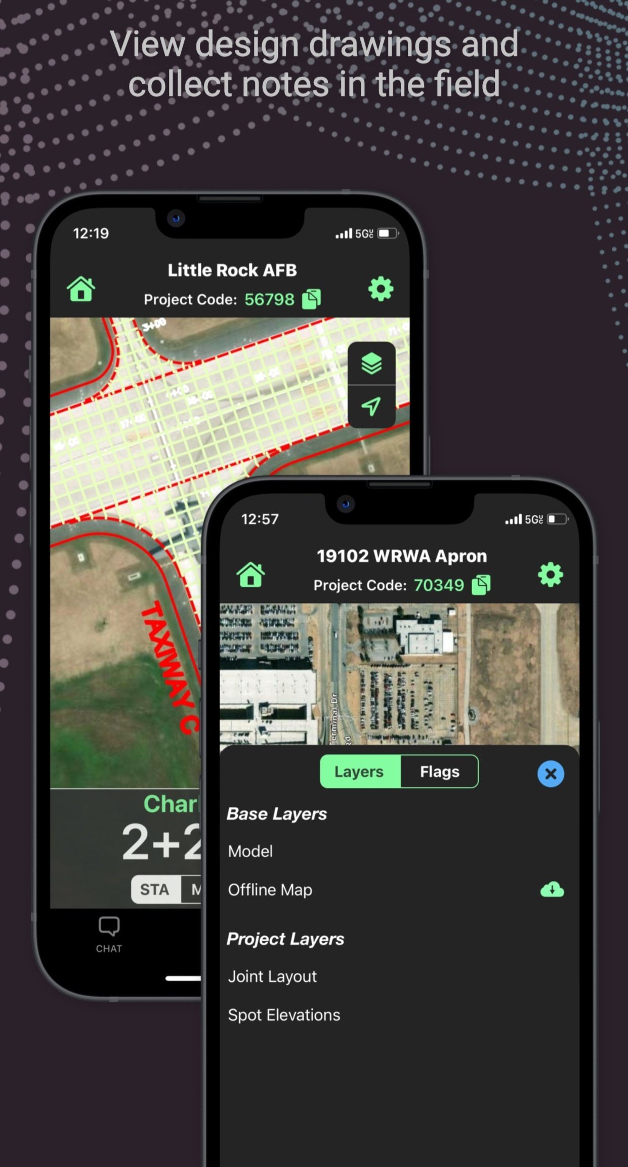
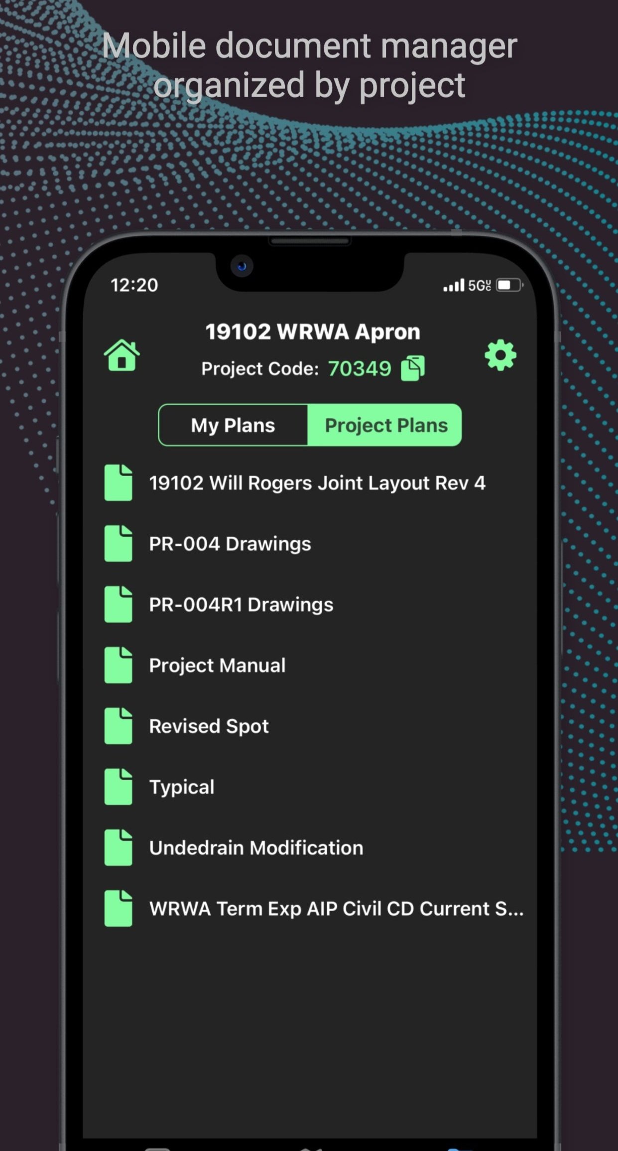
VISUALIZE
Project Plans
Access and view current project plans, specs, and standard drawings instantly. Additional option to include a direct integration to your cloud based storage account, making staying current even easier.
“If you don’t prefer physical copies of plans this is a useful tool.”
NEW
✨
NEW ✨
INTEGRATIONS
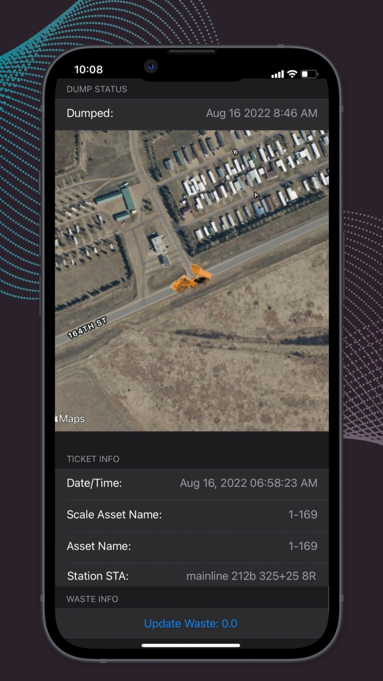
Fleetwatcher
We love data! That’s why we have integrated with Fleetwatcher to import stationing information automatically into e-tickets. Eliminating the manual location entry in a ticket not only increases efficiency, but also removes any human error.
REPORTING
Export Capabilities
Dropbox
➡️
OneDrive
➡️
Google Drive
➡️
box
➡️
Outlook
➡️
Microsoft Teams
➡️
➡️
➡️
Slack
➡️
SMS
➡️
Phone Gallery
➡️
Dropbox ➡️ OneDrive ➡️ Google Drive ➡️ box ➡️ Outlook ➡️ Microsoft Teams ➡️ Facebook ➡️ Instagram ➡️ Slack ➡️ SMS ➡️ Phone Gallery ➡️
“Being able to set flags and chats to communicate with others on the project along with photos of the areas of concern, having a method to record items for record keeping.”
Ready to Get Started?
Start your FREE 30 Day Trial today!